Catalog Archive
Auction 149, Lot 268

"New York", Tallis, John

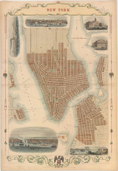
Subject: New York City, New York

Period: 1851 (circa)

Publication: The Illustrated Atlas

Color: Hand Color

Size:
13.6 x 21 inches
34.5 x 53.3 cm
Download High Resolution Image
(or just click on image to launch the Zoom viewer)

The maps from The Illustrated Atlas were first published in serial form to a target audience that led insular lives due to the expense and hardship of travel. All that changed as the progress of the nineteenth century brought swift and dramatic changes in public awareness of far away places. Tallis' maps no doubt played an important role in this dramatic awakening. These maps not only provided up-to-date geographical knowledge, but also used vignette views within the map's design to show the native people and their occupations, cities and points of interest. The maps hark back to a cartographic tradition from the Dutch mapmakers of the seventeenth century with finely engraved decorative borders. The maps were drawn and engraved by John Rapkin with views drawn and engraved by a number of prominent artists. The maps were issued as a complete volume from 1851 until about 1865. Some of the maps were also published in other history books published by Tallis including British Colonies and, without the vignettes, in geographical dictionaries and encyclopedias until about 1880.

This striking bird's-eye plan is one of the few double-page engravings published by Tallis. The plan depicts the southern end of Manhattan up to 42nd Street, and extends to include Williamsburgh and parts of Brooklyn and Jersey City. It is interesting to note three distinct phases of development: irregular street blocks in the southern tip; regular blocks at angles in the second phase; and a uniform block pattern in the northern portion, as ordained by the Commissioner's Plan of 1811. The plan is surrounded by 6 vignettes: a view of New York from Williamburgh, a view of Brooklyn, the narrows from Port Hamilton, a New York steamer, City Hall, and the Customs House. The plan was drawn and engraved by J. Rapkin, and the illustrations were drawn and engraved by H. Winkles. Tallis included very few town plans in The Illustrated Atlas, and they only appeared in later editions, making them quite rare. This engraving is one of the most decorative and sought-after 19th century plans of New York.

References: Goss (Mapping of NA) #81.

Condition: B+

Issued folding with attractive color, minor toning along the centerfold and sheet edges, and a fold separation that enters 1.5" into image at right and has been closed on verso with archival tape.

Estimate: $1,000 - $1,300

Sold for: $700

Closed on 5/21/2014

Archived