Catalog Archive
Auction 149, Lot 182
"A Topographical & Geological Map of the Coal Measures, & of the Muriatiferous & Ferruginous Deposits, in the Secondary Region of the Valley of the Ohio",
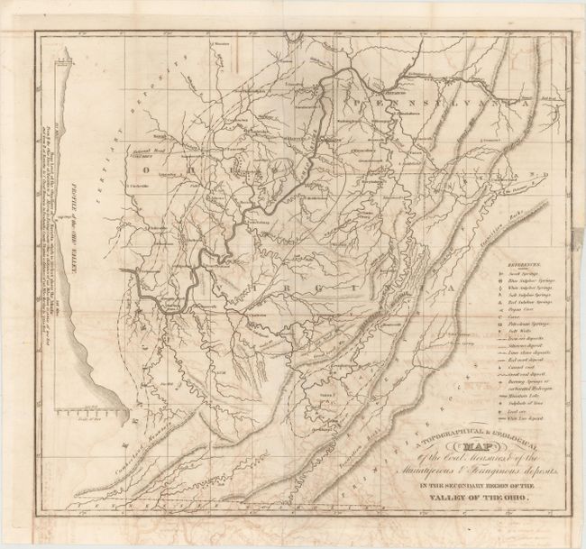
Subject: West Virginia, Ohio, Pennsylvania
Period: 1836 (circa)
Publication: American Journal of Science and Arts, Vol. 29
Color: Black & White
Size:
16.4 x 14.9 inches
41.7 x 37.8 cm
Download High Resolution Image
(or just click on image to launch the Zoom viewer)
(or just click on image to launch the Zoom viewer)