Catalog Archive
Auction 148, Lot 607

"Terra Sancta quae in Sacris, Terra Promissionis Palestina", Mercator/Cloppenburgh
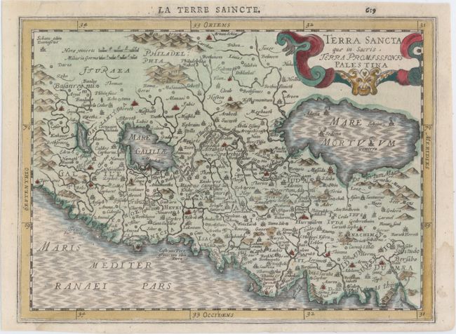
Subject: Holy Land

Period: 1630 (circa)

Publication: Atlas Minor

Color: Hand Color

Size:
10.1 x 7.5 inches
25.7 x 19.1 cm
Download High Resolution Image
(or just click on image to launch the Zoom viewer)

This small map is based on Ortelius' famous map of the Holy Land. It is oriented with east at the top and centered on Samaria. The Dead Sea has four cities shown burning within it: Sodoma, Gomorra, Adama and Seboim. The map is adorned with a strapwork cartouche. French text on verso.

References: Van der Krogt (Vol. III) #8150:353.

Condition: B+

Attractive color with a faint damp stain along bottom of map and a few tiny edge tears that have been professionally repaired.

Estimate: $140 - $170

Sold for: $160

Closed on 2/19/2014

Archived