Catalog Archive
Auction 148, Lot 562

"Hungariae Ampliori Significatu et Veteris vel Methodicae Complexae Regna: Hungariae Propriae, Croatiae Dalmatiae Bosniae Serviae Bulgariae Cumaniae Principatum: Transsylvaniae...", Haas/Homann Heirs

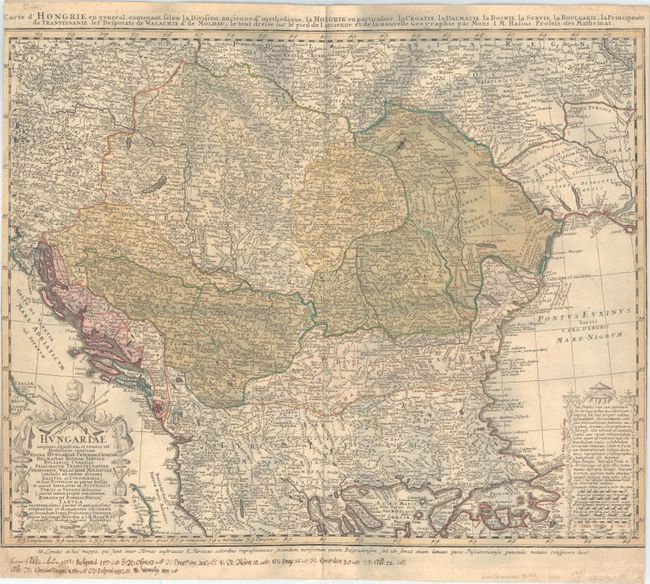
Subject: Hungary, Balkans

Period: 1744 (circa)

Publication:

Color: Hand Color

Size:
23.4 x 18.7 inches
59.4 x 47.5 cm
Download High Resolution Image
(or just click on image to launch the Zoom viewer)

This is a wonderfully detailed map of the region of present-day Hungary, Romania, and the Balkan republics. Political divisions, towns and cities, and topographical details are shown. Johann Matthias Haas was a professor of mathematics at Wittenberg and provided several fine maps for Homann's various atlases. The map is completed by large decorative title and distance scale cartouches at the bottom corners, and an alternate title running along the top: Carte d' Hongrie en General Contenant Selon la Division Ancienne & Methodique, la Hongrie en Particulier la Croatie la Dalmatie, la Bosnie, la Servie la Boulgarie; la Principaute de Transylvanie les Despotats de Walchie & de Moldav....

References:

Condition: B

On a cockled sheet with light toning and some minor soiling. The margins have been trimmed at left and right, with a tiny portion of the neatline missing on both sides. Manuscript notations appear in the lower right corner and lower blank margin, and there are a few small spots in the image. The dark spots in the scanned image are shadows due to the sheet being cockled and do not appear on the actual map.

Estimate: $140 - $180

Sold for: $100

Closed on 2/19/2014

Archived