Catalog Archive
Auction 148, Lot 325
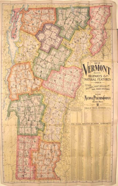
"Complete Map of Vermont Showing Highways & Natural Features…", National Publishing Co.
1 of 2
Subject: Vermont
Period: 1900 (circa)
Publication:
Color: Printed Color
Size:
33.5 x 54.5 inches
85.1 x 138.4 cm
Download High Resolution Image
(or just click on image to launch the Zoom viewer)
(or just click on image to launch the Zoom viewer)