Catalog Archive
Auction 148, Lot 169

"United States of North America (Eastern & Central)", Ettling, Theodor

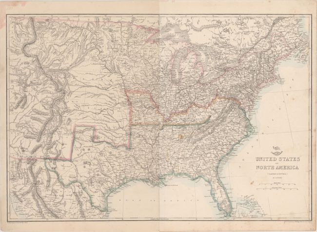
Subject: Eastern United States, Civil War

Period: 1862 (dated)

Publication: Weekly Dispatch Atlas

Color: Hand Color

Size:
25 x 17 inches
63.5 x 43.2 cm
Download High Resolution Image
(or just click on image to launch the Zoom viewer)

This great Civil War map covers the country from the Rocky Mountains to the Atlantic seaboard. Of importance is the designation of the separate Confederate and Union states via hand coloring. The states of Missouri and Kentucky are colored differently to indicate their status as border states containing both pro-Confederate and pro-Union government factions. The Confederate Territory of Arizona is shown in the south of New Mexico Territory. The map is finely engraved and detailed, and it shows existing railroads and several possible routes explored for the proposed Pacific Railroads. The tracks of Fremont, Gunnison and others are shown, as are numerous roads, marshes, forts and Indian tribes. These maps were published in the serial Weekly Dispatch Atlas for later binding into a world atlas, and examples still folding and unbound are uncommon. Published by Cassell, Petier & Galpin, la Belle Sauvage Yard, Ludgate Hill for inclusion in the Weekly Dispatch Atlas. A stamp in the top left corner indicates this map was in the December 28th, 1862 issue. Printed on two sheets, joined.

References:

Condition: B+

A mostly clean sheet with a few minor stains in the image.

Estimate: $150 - $200

Sold for: $160

Closed on 2/19/2014

Archived