Catalog Archive
Auction 148, Lot 129

"Map of the United States in North America: with the British, French and Spanish Dominions Adjoining, According to the Treaty of 1783", Kitchin, Thomas
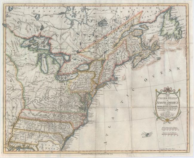
Subject: Eastern United States & Canada

Period: 1783 (dated)

Publication:

Color: Hand Color

Size:
19.7 x 16 inches
50 x 40.6 cm
Download High Resolution Image
(or just click on image to launch the Zoom viewer)

This is one of the earliest English-produced maps to officially acknowledge the United States. It depicts the new nation with its western border on the Mississippi River. Of particular interest is the coloring of Virginia, stretching west to the Mississippi River and north to Lake of the Woods, encompassing nearly a third of the map including today's Minnesota, Wisconsin and Michigan. This coloring was based upon the early 17th century charters which Virginia only realized after the French and Indian War. Virginia would claim these borders for 20 years before they were reduced by cession and civil war. The map is filled with information on early settlements, forts, Indian villages and fishing banks. The title is enclosed in a simple cartouche, with the island of Bermuda below. The map was published in Raynal's A Philosophical and Political History.

An example with the same coloring is found at the Library of Virginia. Click here to view their example.

References: McCorkle #783-11; Phillips (M) p. 862.

Condition: B

Issued folding and now flattened and backed with tissue to reinforce and repair numerous small splits along the folds resulting in minor loss of image primarily in blank areas of the engraving. Light soiling and offsetting.

Estimate: $1,000 - $1,400

Sold for: $2,100

Closed on 2/19/2014

Archived