Catalog Archive
Auction 148, Lot 126

"A New Map of North America from the Latest Discoveries", Spilsbury, J.

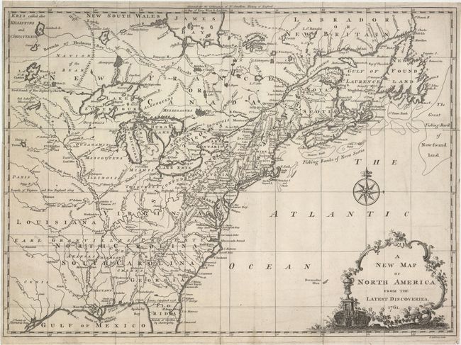
Subject: Colonial United States & Canada

Period: 1761 (dated)

Publication: The Continuation of Dr. Smolletts History of England

Color: Black & White

Size:
14.9 x 10.9 inches
37.8 x 27.7 cm
Download High Resolution Image
(or just click on image to launch the Zoom viewer)

This is the uncommon first state, not the 1763 edition from London Magazine, of this fine map noting the colonial possessions in North America eastward from Texas to the Atlantic coast. It shows early settlements, forts, Indian villages, and tribal territory. The colonies have boundaries extending past the map's western border. Various treaty and charter boundaries are shown. Earl Granville's Property stretches from the Atlantic west to beyond the Mississippi River. In Florida, a line from Fort St. George to St. Mark delineates the Limits Stipulated in 1738 and below, nearly to Cape Canaveral, are the Bounds of Carolina by Charter of 1665. The fishing banks off Canada are prominently outlined. The map is enhanced by a delicate title cartouche and fancy compass rose.

References: McCorkle #761-3; Sellers & Van Ee #89.

Condition: B+

A nice impression on watermarked paper, issued folding, now pressed flat, with one short fold separation entering less than 0.75" into the image that has been closed on verso with archival materials. There is also a tiny edge tear just breaching the neatline at left and some minor soiling.

Estimate: $375 - $475

Sold for: $275

Closed on 2/19/2014

Archived