Catalog Archive
Auction 147, Lot 504
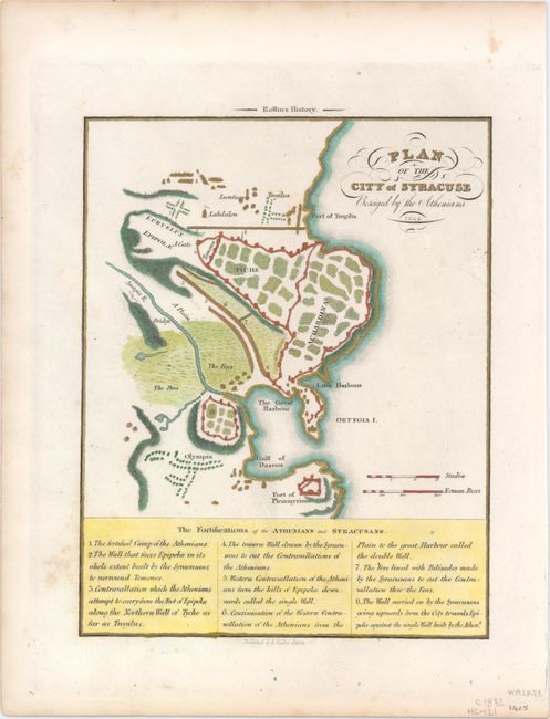
"[Lot of 2] Italy [and] Plan of the City of Syracuse Beseiged by the Athenians", Walker, Samuel

1 of 2
Subject: Italy
Period: 1840-52 (circa)
Publication:
Color: Hand Color
Size:
See Description
Download High Resolution Image
(or just click on image to launch the Zoom viewer)
(or just click on image to launch the Zoom viewer)