Catalog Archive
Auction 147, Lot 118

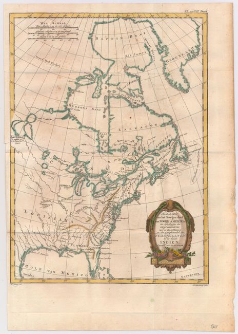
"Kaart van het Noorder deel van Noord Amerika ter Opheldering der Geschiedenis van de Bezittingen...", Bonne, Rigobert

Subject: Colonial United States & Canada

Period: 1778 (circa)

Publication: Wijsgeerige en Staatkundige Geschiedenis van de Bezittingen en den Koophandel...

Color: Hand Color

Size:
9.2 x 12.5 inches
23.4 x 31.8 cm
Download High Resolution Image
(or just click on image to launch the Zoom viewer)

This uncommon map comes from a Dutch translation of Raynal's Histoire Philosphique et Politique... published in 1778. The map shows the British colonies confined along the eastern seaboard with French Louisiana and Canada taking up the interior. In the upper left is a series of rivers and lakes purportedly connecting Hudson Bay with "de West Zee" (the West Sea). Several native tribes are identified, including the Natchitoches in Louisiana Territory. Three distance scales and a fine shield-style cartouche embellish the composition. Engraved by Koning.

References: cf. McCorkle #774.1.

Condition: B+

Issued folding with some light spots and faint offsetting. A slight binding tear at left confined to the blank margin that has been repaired on verso with archival tape.

Estimate: $140 - $170

Sold for: $120

Closed on 11/20/2013

Archived