Catalog Archive
Auction 146, Lot 84

"America", Cluver, Philipp

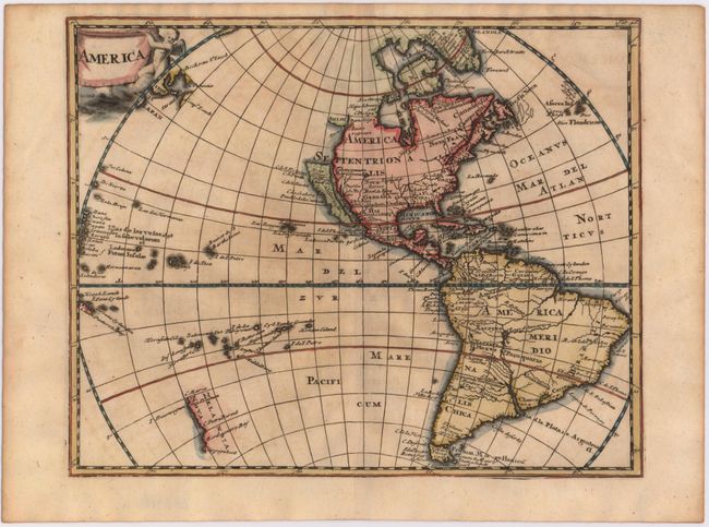
Subject: Western Hemisphere - America

Period: 1697 (published)

Publication: Introductio in Universam Geographicam

Color: Hand Color

Size:
10.3 x 8.3 inches
26.2 x 21.1 cm
Download High Resolution Image
(or just click on image to launch the Zoom viewer)

This handsome small map was derived from the Nicolas Visscher map of 1658, with a Briggs type island of California and no Great Lakes in North America. The interior rivers of South America are all connected to a large, spurious lake labeled Lago de los Xarzyes. A depiction of the discoveries of Maarten Gerritsz de Vries' voyage appears in the waters north of Japan, and Abel Janszoon Tasman's discoveries are shown in New Zealand. This is the first state of the map, decorated by a drape-style title cartouche held aloft by a cherub.

References: Burden #732; McLaughlin #25; Shirley (BL Atlases) #T.CLUV-8a [43].

Condition: B+

Attractive color with very light toning and minor offsetting.

Estimate: $400 - $475

Sold for: $300

Closed on 9/4/2013

Archived