Catalog Archive
Auction 146, Lot 841

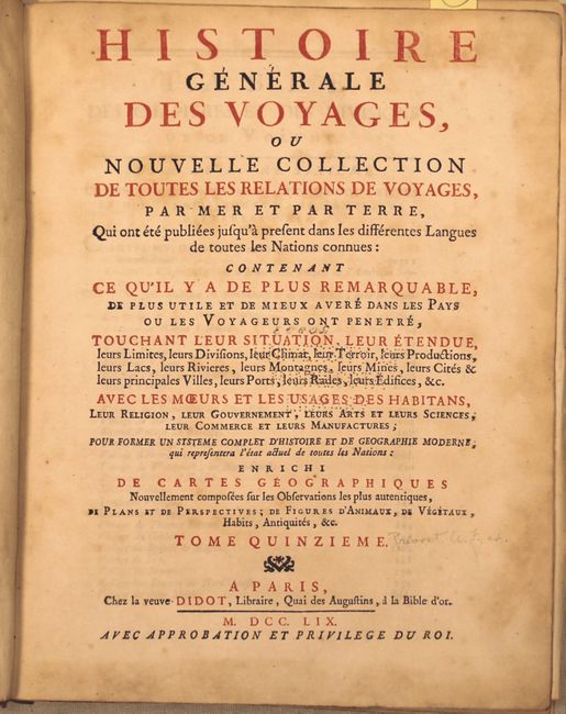
"Histoire Generale des Voyages, ou Nouvelle Collection de Toutes les Relations de Voyages ... Tome Quinzieme", Prevost, Anton Francois

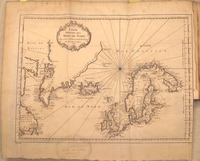
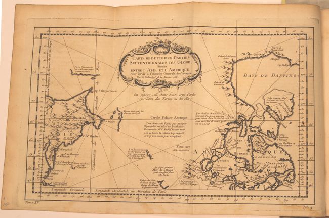
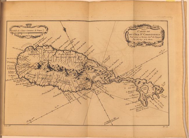
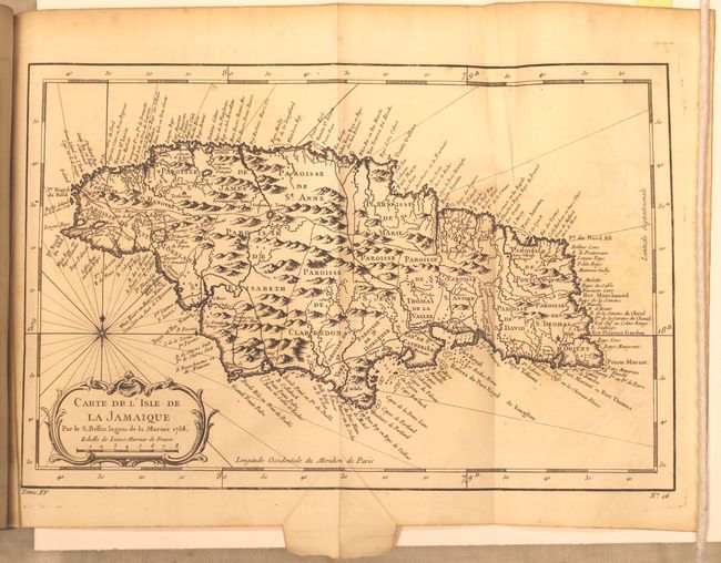
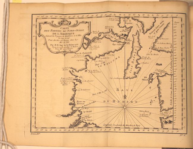
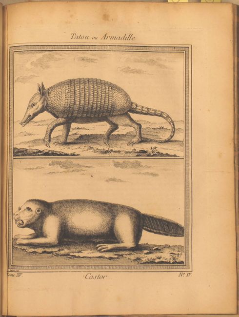
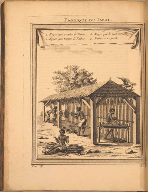
Subject: Exploration and Surveys

Period: 1759 (published)

Publication:

Color: Black & White

Size:
8 x 10.3 inches
20.3 x 26.2 cm
Download High Resolution Image
(or just click on image to launch the Zoom viewer)

This is a very nice example of volume fifteen of Prevost's history of voyages, with maps by Jacques Nicolas Bellin. This is the 1746 "Nouvelle Collection" published in Paris. The volume is divided into two sections and describes explorations in the Northern Atlantic and Arctic Ocean as well as the West Indies. The maps included in this volume are:

Carte Reduite des Mers du Nord (17.5 x 12.8"). This nice chart is centered roughly on Iceland and covers from the eastern shores of Canada through Greenland to Scandinavia and Britain. The coastlines are intricately drawn with coastal place names the only detail. A fine chart with decorative title cartouche and rhumb lines. Condition: Binding trim at right with light offsetting.

Carte du Detroit de Waeigats ou de Nassau (11.8 x 7.8").

Partie de la Mer Glaciale contenant la Nouvelle Zemle... (13.5 x 8.5").

Carte Reduite des Parties Septentrionales du Globe, Situees entre l’Asie et l’Amerique...(13.5 x 8.3"). Very unusual chart that shows only the northeast coastline of Canada with Baffin and Hudson Bay and the St. Lawrence River. On the other side is the northeast coastline of Asia with the Kamchatka peninsula. In between are a few small areas of coastline with notations concerning reported explorations, including those of Juan de Fuca, the Russian expeditions in 1728 and 1741, the reported Sea of the West and the English quests for a Northwest Passage via the Hudson Bay.

Carte du Spits-Berg...(11.8 x 8.5").

Carte des Parties du Nord-Ouest de l’Amerique...(10.5 x 8.2").

Carte du Golphe de Bothne...(6.5 x 8.3").

Suite du Golphe de Bothnie...(6.5 x 8.3").

Carte des Environs de Tornea...(5.8 x 8.1").

Carte de l’Isle de Saint Domingue...(11.2 x 7.5").

Carte de de l’Isle St. Christople...(12 x 7.6"). This lovely map of St. Kitts is divided into twelve quarters and parishes and is fully engraved with mountains, rivers, lakes, and towns. In the center of the island a note on the mountain Mont Misery locates Mines de Souffre. Grande Saline, Ville de la Basse Terre, forts, churches and more are identified. Decorated with baroque-style title and scale of miles cartouches and a fleur-de-lys.

Carte de l”isle de la Martinique...((11.8 x 7.8").

Carte de l’Isle de la Guadeloupe...(11.8 x 8.3").

Carte de l’Isle de la Grenade...(6.1 x 8.3").

Carte de l”isle de Sainte Lucie...(11.8 x 7.8").

Carte de l’Isle de la Jamaique...(12.3 x 8.2"). This strongly engraved and detailed map describes this island of the Greater Antilles. Divided by parishes, the map shows remarkable detail with scores of place names along the coast plus mountains, personal estates, watershed and other details in the interior. At lower left is a decorative rococo-style title cartouche with compass rose and rhumb lines above.

Carte de l”isle de la Barbade...(5.8 x 7.8").

728 pp. of text with 17 maps and 11 plates of illustrations. Hardbound in full calf with gilt title and raised bands on spine.

References:

Condition: B

Maps are good to very good with light toning and offsetting. Covers and spine are chipped and worn with a library pastedown on front cover with library stamp on the first few pages. A few pages, including one page of the table of contents, are loose, and the front cover is beginning to detach.

Estimate: $600 - $800

Sold for: $450

Closed on 9/4/2013

Archived