Catalog Archive
Auction 146, Lot 50
Rare Edition of Bunting's Clover Leaf Map of the Old World
"Tabule Wsseho Ofrsslku Zemskeho W Spusobu Listu Detelowelo", Bunting, Heinrich
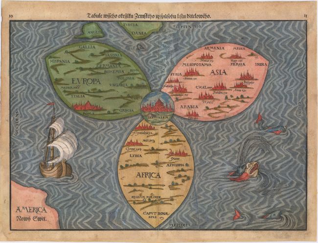
Subject: Ancient World
Period: 1592 (published)
Publication: Itinerarium Sacrae Scripturae
Color: Hand Color
Size:
14.3 x 10.5 inches
36.3 x 26.7 cm
Download High Resolution Image
(or just click on image to launch the Zoom viewer)
(or just click on image to launch the Zoom viewer)