Catalog Archive
Auction 146, Lot 425

"The East Coast of Scotland with the Isles of Orkney and Shetland", Collins, Capt. Greenvile

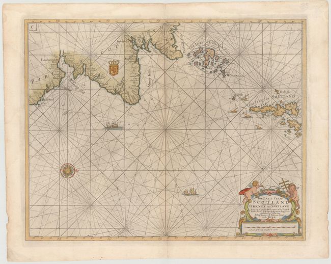
Subject: Northern Scotland

Period: 1693 (circa)

Publication: Great Britain's Coasting-Pilot...

Color: Hand Color

Size:
22 x 17.4 inches
55.9 x 44.2 cm
Download High Resolution Image
(or just click on image to launch the Zoom viewer)

An uncommon sea chart depicts the coastal area of Scotland, including Edinburgh, Dundee, Aberdeen, and Inverness. Decorated with an ornate title cartouche incorporating the scale of miles, the map also features a coat-of-arms and ships navigating through a sea criss-crossed with rhumb lines. In 1681 Captain Greenville Collins was commissioned by the Admiralty to survey the sea coast of Great Britain. His charts were the most detailed maps of the period and greatly improved the previous work of John Seller.

References: Shirley (BL Atlases) M.COLL-1a #31; Moir, p. 10.

Condition: B+

Attractive color with light printer's ink residue and a faint damp stain that just enters the map at left.

Estimate: $350 - $425

Sold for: $180

Closed on 9/4/2013

Archived