Catalog Archive
Auction 146, Lot 332

"Carte de la Terre Ferme, du Perou, du Bresil, et du Pays des Amazones, Dressee sur les Memoires les plus Nouveaux & les Observations les plus Exactes", Chatelain, Henry Abraham

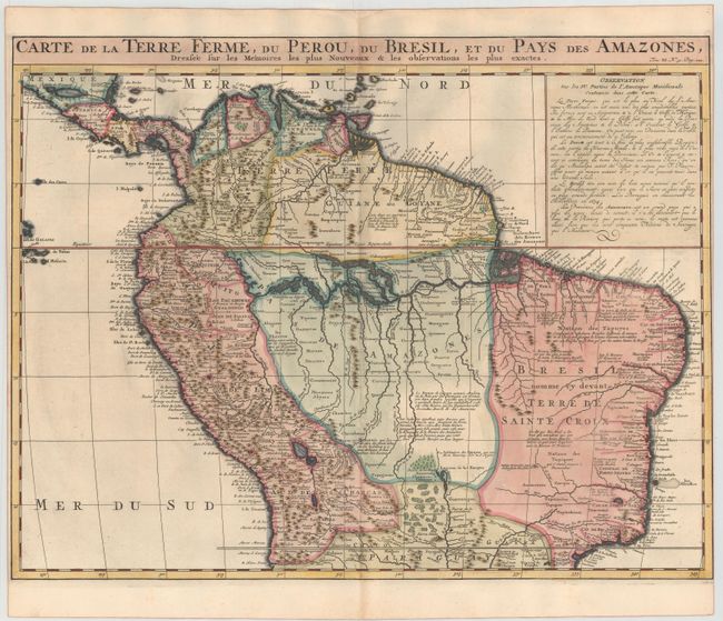
Subject: Northern South America

Period: 1720 (circa)

Publication: Atlas Historique…

Color: Hand Color

Size:
20.7 x 16 inches
52.6 x 40.6 cm
Download High Resolution Image
(or just click on image to launch the Zoom viewer)

Handsome map of the northern part of South America based on the cartography of Guillaume Delisle. It is filled with place names and notations speculating about the Indian tribes and the tributaries of the Amazon. The Capitaineries are named in Brazil and the Inca Way (Grand chemin des Ingas) is shown from Chuquisaca in Peru to Pasto in Colombia.

References:

Condition: B+

A clean, bright sheet with attractive color, a tiny hole in the Pacific, and narrow side margins, as issued.

Estimate: $275 - $350

Sold for: $200

Closed on 9/4/2013

Archived