Catalog Archive
Auction 146, Lot 296

"Central America", Tallis, John

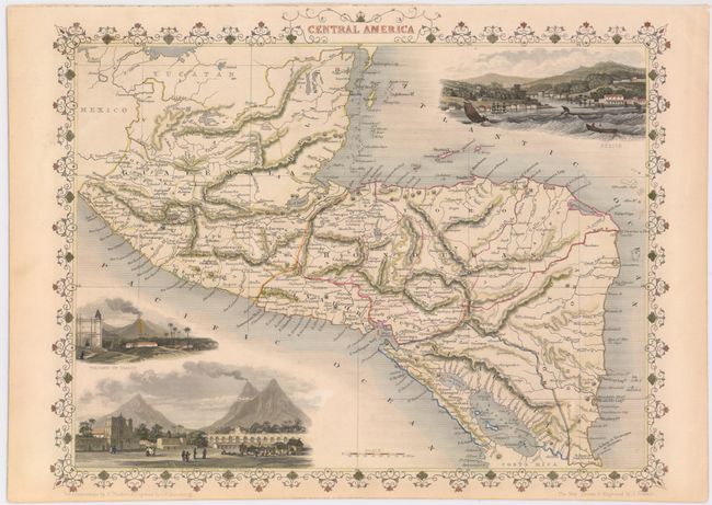
Subject: Central America

Period: 1850 (circa)

Publication: Illustrated Atlas

Color: Hand Color

Size:
12.9 x 10.1 inches
32.8 x 25.7 cm
Download High Resolution Image
(or just click on image to launch the Zoom viewer)

The maps from The Illustrated Atlas were first published in serial form to a target audience that led insular lives due to the expense and hardship of travel. All that changed as the progress of the nineteenth century brought swift and dramatic changes in public awareness of far away places. Tallis' maps no doubt played an important role in this dramatic awakening. These maps not only provided up-to-date geographical knowledge, but also used vignette views within the map's design to show the native people and their occupations, cities and points of interest. The maps hark back to a cartographic tradition from the Dutch mapmakers of the seventeenth century with finely engraved decorative borders. The maps were drawn and engraved by John Rapkin with views drawn and engraved by a number of prominent artists. The maps were issued as a complete volume from 1851 until about 1865. Some of the maps were also published in other history books published by Tallis including British Colonies and, without the vignettes, in geographical dictionaries and encyclopedias until about 1880.

This map features three beautifully rendered vignettes: Volcano of Isalco, Great Square of the Antiqua in Guatemala, and Belize. The map extends from Mexico to Costa Rica and includes the proposed route for a rail and canal system between the Atlantic and Pacific Oceans.

References:

Condition: A

A bright, clean example with a fine impression. There is one archivally repaired tear that just passes neatline at bottom, and light toning along sheet edges.

Estimate: $140 - $170

Sold for: $70

Closed on 9/4/2013

Archived