Catalog Archive
Auction 146, Lot 26

"[Untitled - Trade Winds Chart]", Halley, Edmund
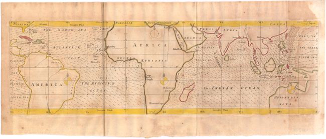
Subject: World

Period: 1686 (circa)

Publication: An Historical Account of the Trade Winds

Color: Hand Color

Size:
19.2 x 5.8 inches
48.8 x 14.7 cm
Download High Resolution Image
(or just click on image to launch the Zoom viewer)

According to Ari Ben-Menahem's Historical Encyclopedia of Natural and Mathematical Sciences, this untitled map of the world is considered to be the first weather map and an early thematic map. The lines in the ocean represent wind direction, and those areas more densely filled in the Indian Ocean represent the region most likely to experience monsoons. The map accompanied Halley's article An Historical Account of the Trade Winds, and Monsoons, Observable in the Seas between and near the Tropicks, with an Attempt to Assign the Phisical Cause of the Said Wind, which was included in issue 183 of the Philosophical Transactions of the Royal Society.

References:

Condition: B

Issued folding with moderate toning and stains.

Estimate: $400 - $500

Sold for: $375

Closed on 9/4/2013

Archived