Catalog Archive
Auction 146, Lot 250

Very Early Map of Oklahoma as a State

"State of Oklahoma", General Land Office
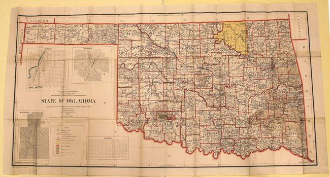
Subject: Oklahoma

Period: 1907 (dated)

Publication:

Color: Printed Color

Size:
42.8 x 21.8 inches
108.7 x 55.4 cm
Download High Resolution Image
(or just click on image to launch the Zoom viewer)

This map was compiled and drawn by I.P. Berthrong from the official records of the General Land Office. The colorful map is keyed to a legend in the lower left, which shows counties, Indian Reserves, Military Reserves and Forest Reserves. It is detailed with many places, rivers and railroads named along with insets of Guthrie, Muskogee, McAlester and Lawton. Osage is still shown as a reservation despite it becoming a county in 1906. Given its date of 1907, this is either the first, or one of the very first, maps of the new state of Oklahoma.

References:

Condition: B+

Issued folding with a two small areas of soiling and a few tiny splits at fold intersections.

Estimate: $275 - $350

Sold for: $400

Closed on 9/4/2013

Archived