Catalog Archive
Auction 146, Lot 212

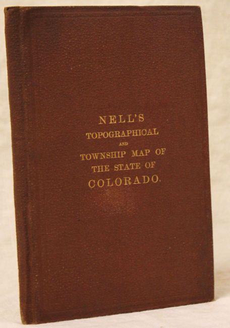
Louis Nell's First Edition Map of Colorado

"Nell's New Topographical & Township Map of the State of Colorado…", Nell, Louis
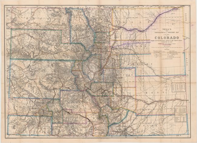
Subject: Colorado

Period: 1880 (dated)

Publication:

Color: Hand Color

Size:
37.8 x 27.5 inches
96 x 69.9 cm
Download High Resolution Image
(or just click on image to launch the Zoom viewer)

This very early, and highly detailed pocket map by Louis Nell is "Compiled from U.S. Government Surveys & other Authentic Sources." The map is fully engraved with virtually no area left untouched by the engraver and is drawn on a scale of 10 miles per inch. County boundaries are beautifully colored in outline with topography, rivers, roads and railroads also depicted. Tables at bottom indicate astronomical positions and arable land. The title cartouche indicates that the map was published by Stone & Co., but has been crossed out and the stamp of Chain & Hardy has been added to the right of the cartouche. Includes red gilt stamped cloth covers (unattached to the map).

Nell came to Colorado in the mid-1870s as a topographical assistant to George Wheeler. Nell enjoyed the area so much that he settled there and published a series of maps of the state beginning in 1880. His detailed maps captured the rapid development of the area, including the great Silver Boom during the 1880s-90s.

References: Brown (Portolan - Spring 2019) pp. 47-53.

Condition: B

Originally issued folding, the map has been flattened, backed in tissue and expertly repaired to close a clean and complete separation down the middle of the map, which was due to it being glued to both the front and back boards (creating stress). There are several manuscript ink notations in the image that has caused minor cracking and tiny loss due to oxidation of the pigment. Faint toning along a few folds.

Estimate: $3,250 - $4,000

Unsold

Closed on 9/4/2013

Archived