Catalog Archive
Auction 146, Lot 194

"[Lot of 3] Territory of Arizona [and] Territory of Arizona [and] Clason's Guide Map of Arizona",
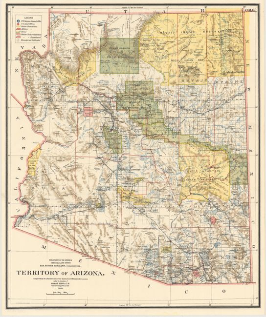
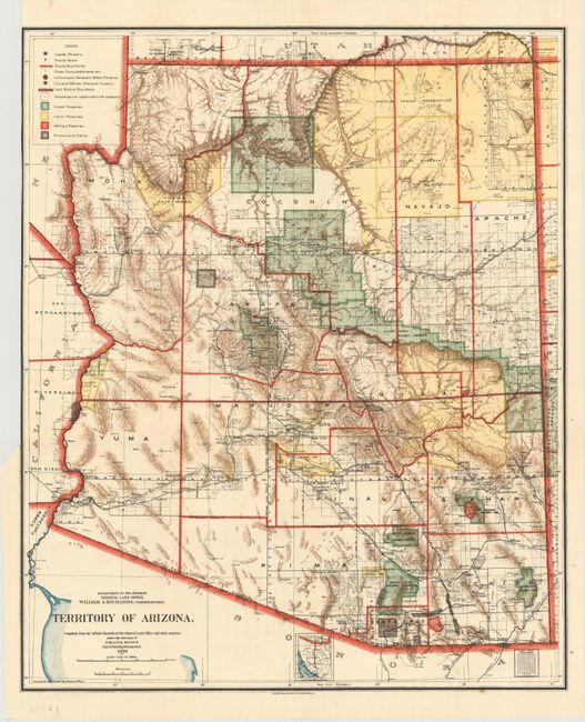
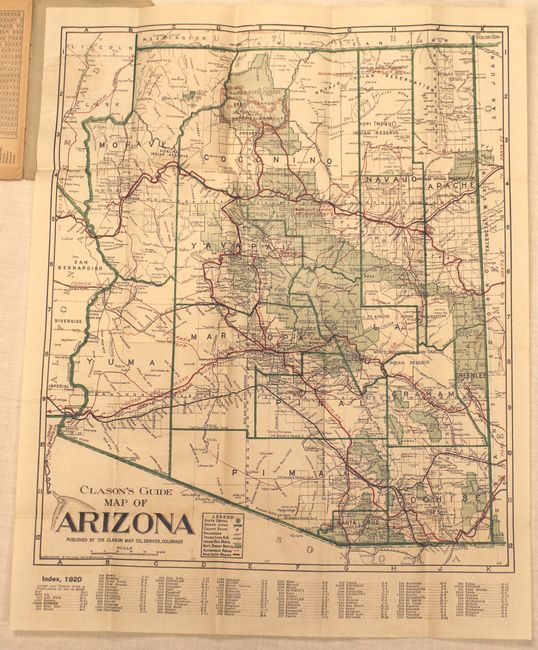
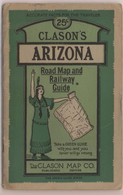
Subject: Arizona

Period: 1899-1920 (circa)

Publication:

Color: Printed Color

Size:
See Description
Download High Resolution Image
(or just click on image to launch the Zoom viewer)

A. Territory of Arizona, by General Land Office, dated 1899 (17.0 x 20.3"). A colorful map with great detail of railroads, cities, roads, extent of surveying, etc., thirteen years before statehood. A legend at upper left provides a key to color coding for topography, Indian Reservations, Military Reservations, and Forest Reserves. Several private land claims, confirmed and unconfirmed, are also shown through color coding. Much of the territory remains to be surveyed and townships subdivided. Locates the Hualpai Indian Reservation, and the Hopi Reservation is still labeled the Moqui Indian Reservation. The Grand Canyon Reserve is shown. The brown hachured mountain areas and the blue waterways combine to provide great visual impact. Information includes watershed, mountains, railroads, wagon roads, private claims and unsurveyed townships. Condition: Issued folding in fine condition. (A+)

B. Territory of Arizona, by General Land Office, dated 1903 (17.0 x 20.7"). An updated map from above, nine years before statehood. The extent of nine Indian reservations and at least four Military reservations, including Fort Apache, are clearly shown in different colors. Private claims, confirmed and unconfirmed, are outlined in red. Of note, this is the first map to name Sedona, here called Sedonia. Condition; Vibrant color on a clean sheet with a binding trim at upper left trimmed to the neatline. (A)

C. Clason's Guide Map of Arizona, by Clason Map Company, circa 1920 (15.0 x 17.7"). This folding pocket map is complete with descriptive booklet, "Clason's Arizona Road Map and Railway Guide" (4 x 6.3"). The map delineates early Automobile Roads and Main Automobile Roads via different sized red overprinted line. The road network contains a remarkable number of roads and highways. The legend also locates the state capital (Phoenix), counties lines, county seats, railroads, rail trunk lines, Indian reservations, and National Forests. Below the map is a list of towns with populations: Phoenix had just over 30,000 people, a number that stayed small until air conditioning came into commercial use. The map shows Greenlee County, created from part of Graham County in 1909. Folds into paper covers with 24-page booklet which includes full-page city plans of Tucson and Phoenix. This scarce Clason issue is not dated but shows the Grand Canyon National Park (created 1919), but not the Navajo Bridge at Lee's Ferry which was opened in 1929. Condition: The map is in very good condition with some occasional faint toning and a few extraneous creases. The booklet is toned with some wear. (B+)

References:

Condition:

See descriptions above.

Estimate: $275 - $350

Sold for: $250

Closed on 9/4/2013

Archived