Catalog Archive
Auction 146, Lot 101

"A New and Accurate Map of North America Drawn & Engrav'd from the Best Authorities", Gibson, John

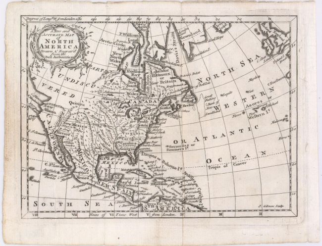
Subject: North America

Period: 1760 (circa)

Publication: The Universal Gazetteer

Color: Black & White

Size:
7.6 x 5.6 inches
19.3 x 14.2 cm
Download High Resolution Image
(or just click on image to launch the Zoom viewer)

This small but detailed map of North America spans from the upper expanses of Canada to the northern tip of South America, and east to include Britain. The colonies are identified, as is French Louisiana, New Mexico, and California. Virginia, the Carolinas, and Georgia extend west to the Mississippi River. West of the Mississippi, only two cities appear: Senis in Texas and Sta. Fee. The land north of Baja California is named New Albion, and the mythical land of Quivira is shown in the west. The northwest frontier of the continent is labeled Parts Undiscovered.

References: McCorkle (18th C. Geography Books) #420.4.

Condition: A

Issued folding with some minor soiling and a couple of extraneous creases that barely affect image.

Estimate: $150 - $180

Sold for: $110

Closed on 9/4/2013

Archived