Catalog Archive
Auction 145, Lot 787

"The Gallapagos Islands Discovered and Described by Capt. Cowley in 1684", Harris, John

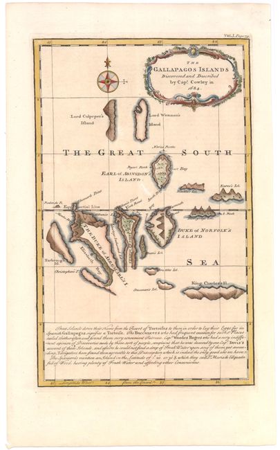
Subject: Galapagos Islands

Period: 1744 (circa)

Publication: Navigantium atque Itinerantium Bibliotheca

Color: Hand Color

Size:
7.7 x 12.3 inches
19.6 x 31.2 cm
Download High Resolution Image
(or just click on image to launch the Zoom viewer)

Delightful map of the Galapagos from a book published by John Harris. The islands were all given names by Cowley to flatter English royalty back home, so we have here named The Duke of Albemarle's I (Isabella), Narborough Isl, (Fernandina) and Duke of Norfolk's Island (St. Cristobal) to name a few. The cartography is not totally precise yet, but the shapes are very clear. There is some interesting text at the bottom describing the tortoises to be found there, as well as the misfortune of listening to buccaneer's descriptions about the water and 'other conveniences' to be found on the islands. A beautifully engraved floral cartouche tops the map along with a handsome compass rose. Engraved by Emanuel Bowen.

References: Shirley (BL Atlases) G.HARR-1a #3.

Condition: B+

A fine impression with good margins and a few light spots.

Estimate: $300 - $400

Sold for: $220

Closed on 6/12/2013

Archived