Catalog Archive
Auction 145, Lot 29

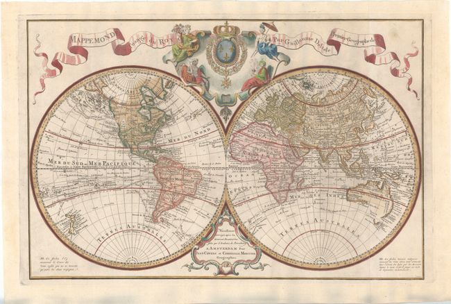
"Mappemonde a l'Usage du Roy", Delisle/Covens & Mortier

Subject: World

Period: 1770 (circa)

Publication:

Color: Hand Color

Size:
26.1 x 17 inches
66.3 x 43.2 cm
Download High Resolution Image
(or just click on image to launch the Zoom viewer)

Covens and Mortier issued this impressive large double hemisphere map based upon the work of both Delisle and Bauche. The map shows well formed continents with the latest discoveries as mentioned in the cartouche at bottom. The routes of numerous explorers are depicted, including Magellan (1520), Mendanna (1595), Quiras (1605), Le Maire (1615), Tasman (1642), St. Louis (1708), and Antoine (1710). The western portion of North America is still largely blank with the exception of a large Mer de l'Ouest. A broken coastline continues to the northwest with several notes of explorers' discoveries. Australia and New Zealand are only partially mapped, and there is no sign of Hawaii, indicating that this map does not include updates based on Captain Cook's second and third voyages. Above the map is a decorative cartouche featuring the French coat of arms surrounded by allegorical figures representing the four continents. This is the fourth state, with the additional coastline added to the northwest coast of North America. Engraved by J. Condet. Printed on two joined sheets, as issued.

References: McGuirk #82.

Condition: B+

Attractive color on watermarked paper with good margins. A portion of the joint between the two sheets (around Australia) has come loose.

Estimate: $1,500 - $1,700

Unsold

Closed on 6/12/2013

Archived