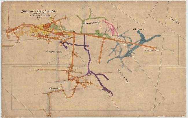
During the silver mining boom in Aspen, Colorado, there were often disputes between the owners of mining claims regarding the exact boundaries of their claims. One such dispute arose between the Durant mine and the owners of several adjacent mines. The dispute was resolved by the formation of the Compromise Mining Company in 1887, in which each owner of the disputed claims conveyed portions of their claims to the Compromise Mining Company in return for a portion of the 10,000 shares of capital stock. The owner of the Durant Mine was granted half of the shares of stock in the Compromise Mining Company, and the remaining shares were held by a trustee for the benefit of the owners of the adjacent claims who had conveyed land to the company, because the remaining owners could not agree to the relative value of each of their conveyed claims. Based on their agreement, the owners of the adjacent claims would receive half of the net proceeds from all the ores taken from the lands they had each conveyed, with the remaining half being paid to the Durant mine.
This fascinating manuscript map depicts the area a decade after the formation of the Compromise Mining Company. The silver mines owned by the Durant mine and the Compromise Mining Company are depicted, including the intricate shafts of the Aspen, Conomara, Forest, Stilwell and Schiller mines. Various levels of the Aspen mine are shown, and several fault lines are depicted in red. Dates are marked in intervals in the shafts to indicate when they were mined. The map is oriented with north to the bottom left. The numerous pencil notations throughout the map indicate that this was a working map during the time.
References:
Condition: B+
Lightly soiled with a few small abrasions and creases. Backed in linen. Very good condition for a working map of this type.