Catalog Archive
Auction 145, Lot 230

"[Untitled - Chart of Mobile Bay]",

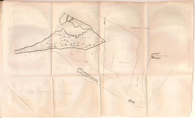
Subject: Mobile, Alabama

Period: 1822 (published)

Publication: HR Doc No. 99, 17th Congress, 1st Session

Color: Black & White

Size:
18 x 10.5 inches
45.7 x 26.7 cm
Download High Resolution Image
(or just click on image to launch the Zoom viewer)

This is one of the earliest maps published by the U.S. government in the serial set. It shows Dauphin Island and Mobile Point, each with a proposed fort identified. These two locations became Fort Gaines and Fort Morgan and were occupied by the Confederacy during the Civil War, but were ultimately taken over by the Union army during the Battle of Mobile Bay. Accompanied by 24 pages of related text.

References: Claussen & Friis #2.

Condition: B+

Issued folding on thick paper with faint offsetting and an extraneous crease in the lower blank margin. Disbound report.

Estimate: $100 - $130

Sold for: $140

Closed on 6/12/2013

Archived