Catalog Archive
Auction 145, Lot 229

"[Lot of 4 - Civil War]", U.S. Army

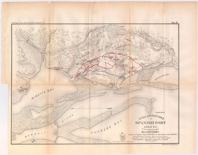
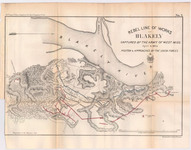
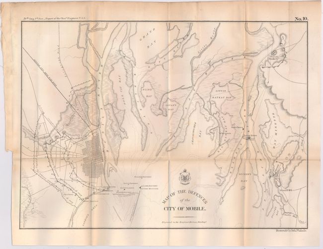
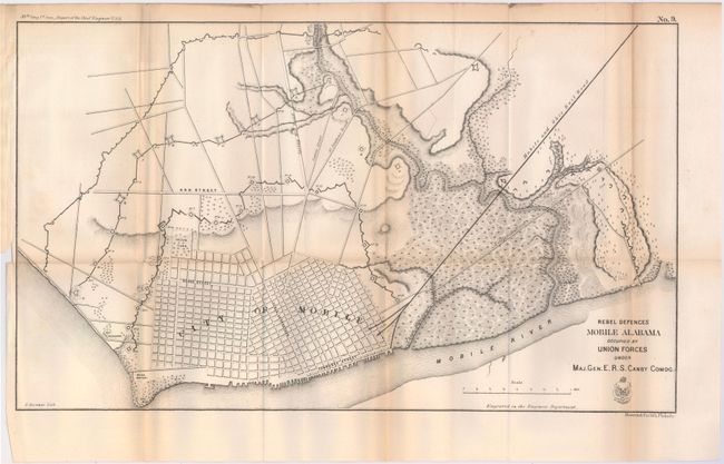
Subject: Alabama, Civil War

Period: 1866 (published)

Publication: Report of Chief Engineer U.S.A., 39th Congress, 1st Session

Color:

Size:
See Description
Download High Resolution Image
(or just click on image to launch the Zoom viewer)

This lot of four Civil War maps shows the defenses as well as troop positions of both the Union and Rebel armies around Mobile Bay and the Blakely River. Information includes roads, villages, railroads, watershed and the terrain in hachure. The coat-of-arms for the Army Corps of Engineers is shown next to each title. These maps are plates No. 7 - No. 10 from the report and are early published Civil War maps; most reports and maps withheld publication until the 1890's to allow time for the national wound to heal sufficiently for a public discussion of the conflict.

A. Siege Operations at Spanish Fort Mobile Bay by the U.S. Forces Under Maj. Gen. Canby, printed color (16.8 x 12.1").

B. Rebel Line of Works at Blakely, printed color (14.9 x 10"). Condition: Trimmed to the neatline at lower left.

C. Map of the Defences of the City of Mobile, black & white (15.3 x 11").

D. Rebel Defences Mobile Alabama Occupied by Union Forces Under Maj. Gen. E. R. S. Canby Comdg., black & white (21.4 x 12.6").

References: Stephenson (CW) #105, #107, #108 & #112.

Condition: B+

Issued folding with light toning along the folds, a few short splits at fold intersections, and binding trims at lower left.

Estimate: $200 - $250

Sold for: $150

Closed on 6/12/2013

Archived