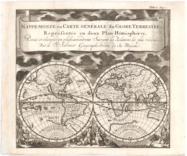
"Mappe-Monde ou Carte Generale du Globe Terrestre Representee en deux Plan-Hemispheres Revue et Changee en Plusieurs Endroits Suivant les Relations les plus Recentes", Sanson, Nicolas
Subject: World
Period: 1743 (published)
Publication: L'Histoire Generale et Political, de l'Universe
This uncommon double hemisphere map is beautifully decorated with clouds at the top and allegorical representations of the continents along the bottom. The graceful banner-style title cartouche attributes the geography to Sanson. California is shown as an island with an incomplete coastline in the Pacific Northwest, which was yet to be explored and charted. The Great Lakes do not yet appear but there is a large St. Lawrence River. T. de Iesso stretches between Asia and North America. In the southern hemisphere, there is a bit of Il. Zelande near and almost connecting to the large T. Magellanique Aust. et Incongneve, and Australia (Nouv. Hollande) is only partly mapped. This is a smaller version of a map by Jan Luyts (Shirley #553), published in Baron Pufendorf's "L'Histoire Generale et Political, de l'Universe" in 1743.