Catalog Archive
Auction 144, Lot 265

"Mer de Sud, ou Pacifique, Contenant L'Isle De Californe, les Costes de Mexique, du Perou, Chili, et le Detroit de Magellanique, &c.", Mortier, Pierre

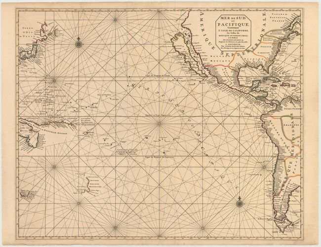
Subject: Pacific Ocean

Period: 1693 (circa)

Publication: Le Neptune Francois

Color: Hand Color

Size:
29 x 23.5 inches
73.7 x 59.7 cm
Download High Resolution Image
(or just click on image to launch the Zoom viewer)

While focused on the Pacific Ocean, this uncommon and dramatic sea chart covers nearly all of North America and a good deal of South America. It prominently features the island of California using the information from Luke Foxe's map of the region with bays on the northern coast, an array of islands in the Mer Vermeio, and the large Agabela de Gato peninsula shown in the Pacific Northwest. The island of Japan is shown with an amorphous Hokkaido named Terre d'Eso ou Yedso from the de Vries expedition. Partial coastlines are mapped for New Zealand, Northern Australia, Tasmania and New Guinea.

Le Neptune Francois was the most expensive sea atlas published in Amsterdam during the latter part of 17th century. This map is from the expanded atlas with the Suite du Neptune Francois, ou Atlas Nouveau des Cartes Marines, a group of maps copied by Nicolas Fremont d'Ablancourt from manuscript maps collected by the Portuguese crown; a rare occurrence because Portugal was notorious for keeping their geographical sources secret. Printed on two sheets, joined as issued.

References: McLaughlin #137; Tooley (America) p.127, #64; Tooley (MCC-23) #57.

Condition: B+

A fine impression with original color and minor offsetting. There are several cracks caused by the oxidation of the green pigment, all of which have been closed on verso with archival material.

Estimate: $3,500 - $4,250

Sold for: $2,500

Closed on 4/3/2013

Archived