Catalog Archive
Auction 144, Lot 20

"Southern Hemisphere ", Faden, William
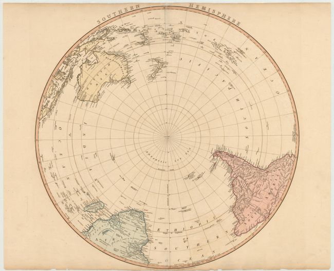
Subject: South Pole

Period: 1802 (dated)

Publication: General Atlas

Color: Hand Color

Size:
23 x 22.5 inches
58.4 x 57.2 cm
Download High Resolution Image
(or just click on image to launch the Zoom viewer)

This polar map shows the discoveries of the Antarctic explorers Halley (1700), Bouvet (1739), and de St. Alouarn (1772). Australia is shown with Van Diemen's Land located on both the northern coast and as an island south of the continent, with Bass's Strait named. Portions of New Guinea and the area around Princess Charlotte Bay in Australia are still not fully delineated. The map also includes the southern tip of Africa and most of South America, with numerous islands depicted throughout the southern hemisphere. This edition is updated from Faden's 1775 edition, with additional information from Cook's 1771 exploration along the southern coast of Australia.

References: Perry & Prescott #1802.05; Tooley, p. 75 #560.

Condition: B

Light offsetting with centerfold separations at top and bottom that have been archivally repaired. There are a few small edge tears, two of which just enter map border.

Estimate: $400 - $500

Sold for: $240

Closed on 4/3/2013

Archived