Catalog Archive
Auction 144, Lot 173

"L'Ocean pres d'Europe, avec les Costes de France, d'Espagne, de Portugal, d'Angleterre, de Holande, de Danemarc & suivant les Cartes Marines les plus Nouvelles", Duval, Pierre

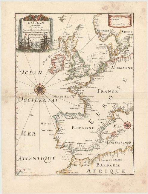
Subject: Western Europe

Period: 1677 (dated)

Publication: Cartes de Geographie les plus Nouvelles…

Color: Hand Color

Size:
13.3 x 18.5 inches
33.8 x 47 cm
Download High Resolution Image
(or just click on image to launch the Zoom viewer)

Very handsome chart by a famous 18th century cartographer, Pierre Du Val (1618-1683) shows the North Atlantic Ocean and the coast of western Europe from Scandinavia and Great Britain down to North Africa. The chart depicts all harbors around the coastlines with no inland detail. The chart includes a rare reference to the Kimmen Line, which indicates a depth of 100 fathoms from Denmark to just west of the Shetland Isles, north of Scotland. Two compass roses with radiating rhumb lines fill the ocean and the Mediterranean. The decorative title cartouche is ornamented with two fighting ships and is topped with a figurehead and scrolls.

References: Pastoureau, DUVAL II D.

Condition: B

Attractive color on watermarked paper and damp stains primarily confined to blank margins. There are professional repairs to a centerfold separation at left with an adjacent 2" tear in image and small chip in blank margin.

Estimate: $400 - $500

Sold for: $450

Closed on 4/3/2013

Archived