Catalog Archive
Auction 144, Lot 159

"A New Chart of the Sea Coast of Scotland with the Islands thereof", Mount & Page
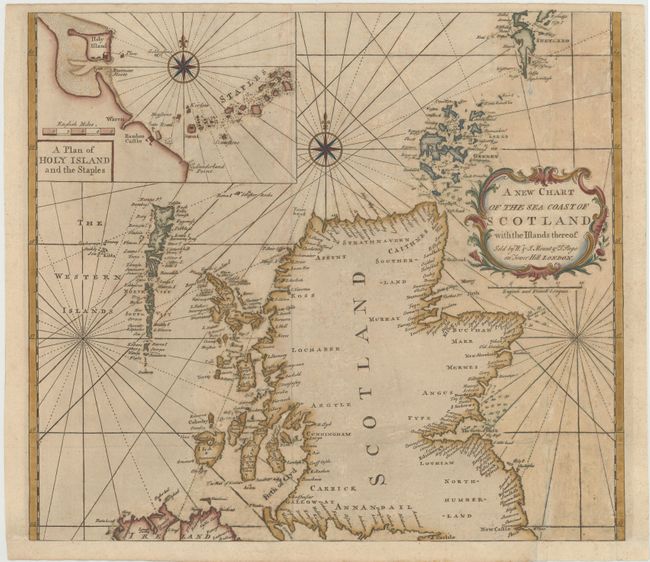
Subject: Scotland

Period: 1771 (circa)

Publication: The English Pilot, the Southern Navigation

Color: Hand Color

Size:
21 x 18.5 inches
53.3 x 47 cm
Download High Resolution Image
(or just click on image to launch the Zoom viewer)

A handsome sea chart of Scotland, including the Outer Hebrides, the Orkney Islands, and the Shetland Islands. The chart locates all major ports, harbors, and castles along the coasts, with no inland detail. Soundings are shown along the east coast in the Firth of Forth and around Buchan Ness, as well as within the Orkney Islands. Included is an inset chart titled A Plan of Holy Island and the Staples on the Northumberland coast, showing Bambro Castle, sand banks and navigation hazards. The chart is adorned with a decorative rococo title cartouche and two compass roses.

References: Shirley (BL Atlases) M.M&P-1d #4.

Condition: B

Issued folding, now pressed, with professional repairs to several fold separations and some tiny holes. There is light soiling, a bit of scattered foxing, and numerous tiny abrasions. Remargined at bottom with old paper to accommodate framing.

Estimate: $400 - $500

Sold for: $425

Closed on 4/3/2013

Archived