Catalog Archive
Auction 144, Lot 11

"A General Chart of the World on Mercator's Projection, Exhibiting all the New Discoveries, and the Tracks of the Different Circum Navigators", Malham, John (Rev.)
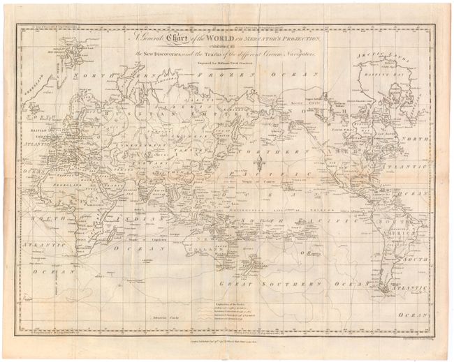
Subject: World

Period: 1795 (dated)

Publication: Naval Gazetteer

Color: Black & White

Size:
17.8 x 13.3 inches
45.2 x 33.8 cm
Download High Resolution Image
(or just click on image to launch the Zoom viewer)

This chart of the world outlines the tracks of Captain Cook on his three major voyages of exploration. A key at bottom identifies the tracks of the Endeavour from 1768-71, the Resolution and Adventure from 1772-75, and the Resolution and Discovery from 1776-80. The voyage of the HMS Racehorse and HMS Carcass, commanded by Constantine John Phipps in 1773, is also shown, depicting his attempt at finding a northwest passage from the Atlantic Ocean to the Pacific Ocean. In North America, the northwest coast is not yet fully delineated, and a River of the West is shown extending from Nootka Sound. California is labeled New Albion. Australia is named New Holland with numerous new discoveries by Cook. Diemens Land is still connected to the mainland, as this chart was published just a few years prior to the discovery of Bass Strait by George Bass and Matthew Flinders. There is no sign of Antarctica, except for Sandwich Land at the 60th Parallel. This chart was engraved by Samuel John Neele for Rev. John Malham (1747-1821), a writer and teacher of navigation who authored The Naval Gazetteer; or, Seaman's Complete Guide. From the first British edition.

References: McCorkle (Maps in 18th Century Geography Books) #251, Vol. I-1.

Condition: B

Issued folding, now flattened, with light toning along several folds and some short fold separations that have been archivally repaired. There is also some soiling and minor foxing.

Estimate: $200 - $240

Sold for: $150

Closed on 4/3/2013

Archived