Catalog Archive
Auction 143, Lot 625
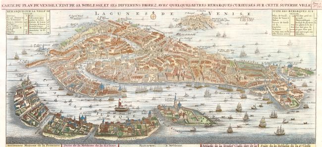
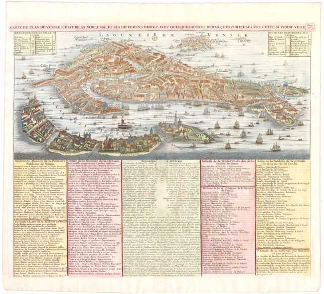
"Carte du Plan de Venise, l'Etat de sa Noblesse, et ses Differens Degrez, avec Quelques autres Remarques Curieuses sur cette Superbe Ville", Chatelain, Henry Abraham
1 of 2
Subject: Venice, Italy
Period: 1708 (circa)
Publication: Atlas Historique…
Color: Hand Color
Size:
17.8 x 7.7 inches
45.2 x 19.6 cm
Download High Resolution Image
(or just click on image to launch the Zoom viewer)
(or just click on image to launch the Zoom viewer)