Catalog Archive
Auction 143, Lot 617

"Carte de Geographie des Differents Etats de la Republique de Venise...", Chatelain, Henry Abraham

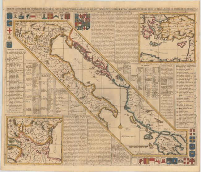
Subject: Eastern Italy

Period: 1718 (circa)

Publication: Atlas Historique

Color: Hand Color

Size:
24 x 19.7 inches
61 x 50 cm
Download High Resolution Image
(or just click on image to launch the Zoom viewer)

This full folio sheet focuses on the geography, politics and military achievements of the Republic of Venice. The central map shows the Adriatic Sea flanked by Italy and the Balkans, with the Republic of Venice at top. At bottom left is an enlarged map of the region surrounding the Republic of Venice, and a counter-balancing map at top right shows the eastern Mediterranean and illustrates countries where the Republic of Venice has gone to battle. The three maps are surrounded by numerous coats of arms, an index of locations of cities on the maps, and French text describing the government and military pursuits of the Republic of Venice.

References:

Condition: B+

Issued folding with a hint of toning and two short fold separations at bottom that have been closed with archival tape.

Estimate: $350 - $425

Sold for: $220

Closed on 2/13/2013

Archived