Catalog Archive
Auction 143, Lot 56
Bunting's Clover Leaf Map of the Old World
"Die Gantze Welt in ein Kleeberblat / Welchs ist der Stadt Hannover Meines Lieben Vaterlandes Wapen", Bunting, Heinrich
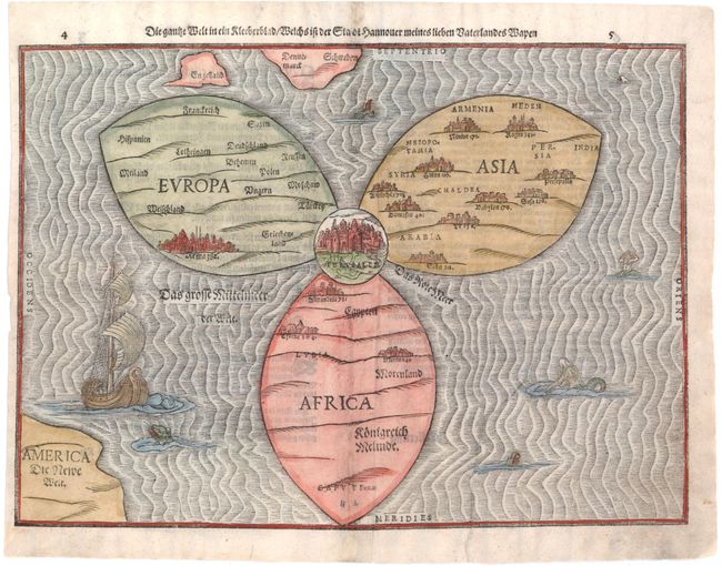
Subject: Ancient World
Period: 1581 (circa)
Publication: Itinerarium Sacrae Scripturae
Color: Hand Color
Size:
14.3 x 10.7 inches
36.3 x 27.2 cm
Download High Resolution Image
(or just click on image to launch the Zoom viewer)
(or just click on image to launch the Zoom viewer)