Catalog Archive
Auction 143, Lot 486
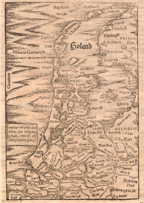
"Holand", Munster, Sebastian
1 of 2
Subject: Western Netherlands
Period: 1578 (published)
Publication: Cosmographey
Color: Black & White
Size:
5.5 x 8.1 inches
14 x 20.6 cm
Download High Resolution Image
(or just click on image to launch the Zoom viewer)
(or just click on image to launch the Zoom viewer)