Catalog Archive
Auction 143, Lot 438

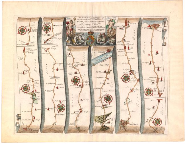
"The Roads from Chelmsford in Essex to Maldon, Raleigh in Essex Gravesend in Kent", Ogilby, John

Subject: England

Period: 1675 (circa)

Publication: Britannia

Color: Hand Color

Size:
16.5 x 13 inches
41.9 x 33 cm
Download High Resolution Image
(or just click on image to launch the Zoom viewer)

John Ogilby's 'Britannia' was published between 1675 and 1698. It is a landmark in the mapping of England and Wales. Its unique format constituted the first national road-atlas of any country in Western Europe. It was composed of maps of seventy-three major roads and cross-roads, presented in a continuous strip-form, on a uniform scale of one inch to a mile. Each beautiful map includes wonderful detail of the countryside with each strip containing a large compass rose to indicate changes in direction.

A very nice strip-style road map that details the route from Chemsord to Gravesend on the Thames. The last two panels detail the side branch from Canterbury to Dover. Filled with details, it includes villages, bridges, castles, windmills, and river crossings. This fine sheet is decorated with numerous compass roses and a boldly engraved title cartouche featuring the royal coat-of-arms flanked with figures including Neptune on a chariot pulled by three hippocampi.

References:

Condition: B+

Nice impression on watermarked paper with faint offsetting and a few small spots.

Estimate: $400 - $500

Sold for: $375

Closed on 2/13/2013

Archived