Catalog Archive
Auction 143, Lot 341
"Isola de Iames, o Giamaica, Possedutta del Re Britannico Divisa in Parrocchie...", Coronelli, Vincenzo Maria
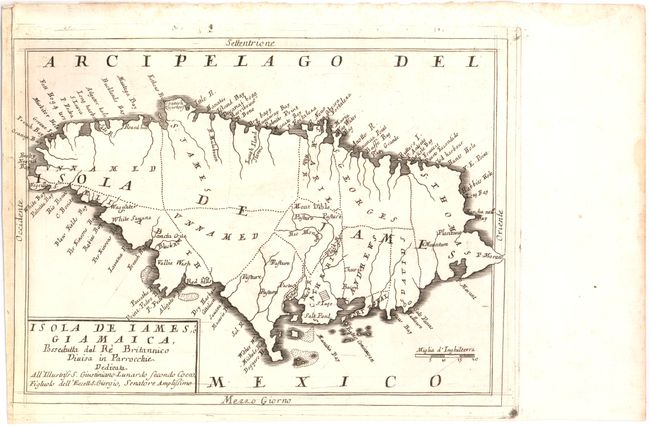
Subject: Jamaica
Period: 1695 (circa)
Publication: Corso Geografico Universal…
Color: Black & White
Size:
11.6 x 8.7 inches
29.5 x 22.1 cm
Download High Resolution Image
(or just click on image to launch the Zoom viewer)
(or just click on image to launch the Zoom viewer)