Catalog Archive
Auction 142, Lot 749

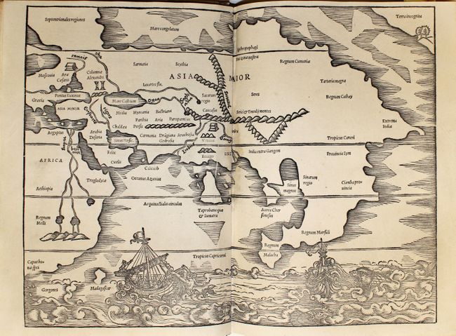
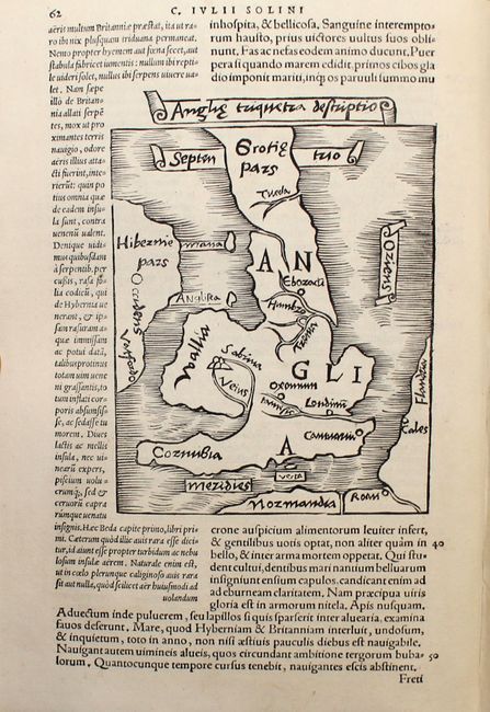
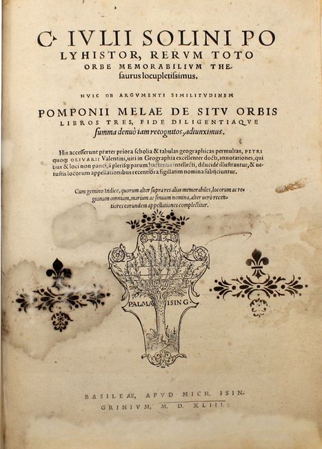
Earliest Depiction of the Northwest Coast of America on a Printed Map

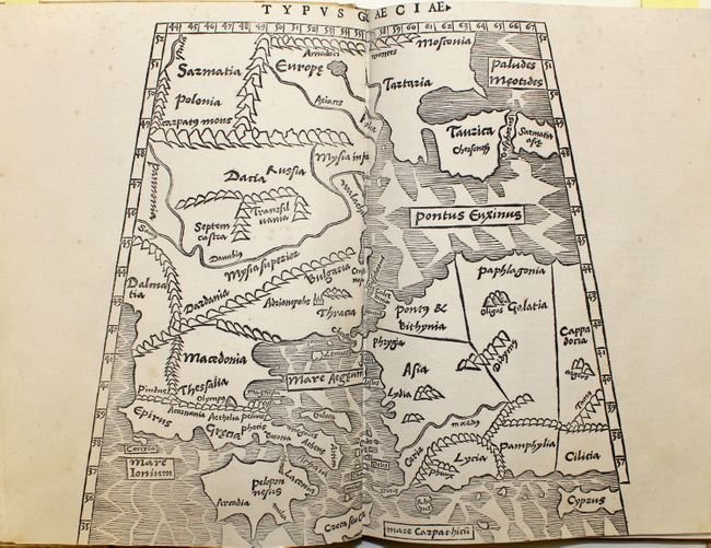
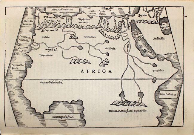
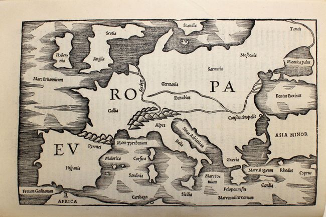
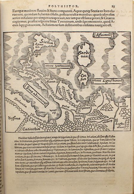
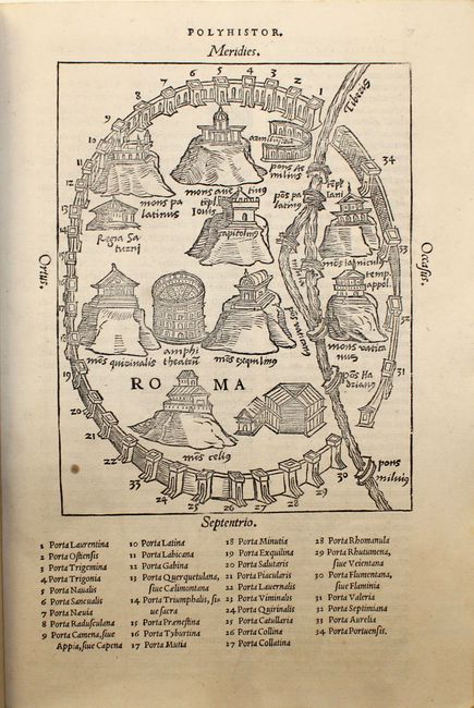
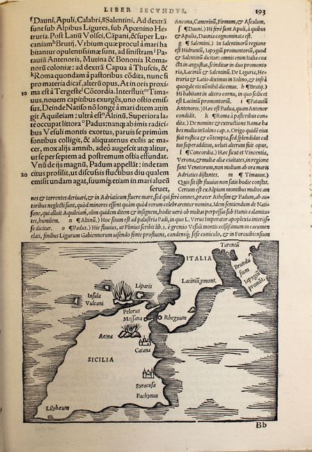
"C. Iulii Solini Polyhistor, Rerum Toto Orbe Memorabilium Thesaurus Locupletissimus... Pomponii Melae de Situ Orbis Libros Tres…", Solinus, Caius Julius

Subject: Atlases

Period: 1543 (dated)

Publication:

Color: Black & White

Size:
8 x 10.6 inches
20.3 x 26.9 cm
Download High Resolution Image
(or just click on image to launch the Zoom viewer)

This geographical description of the world contains the works from both Caius Julius Solinus' Polyhistor and Pomponius Mela's De Situ Orbis Libri III written in three parts. Solinus was a Roman grammarian from the 3rd century who borrowed largely from Pliny's Natural History, reinterpreting it from a geographical perspective. Mela is credited as being the first Roman geographer, who was born in southern Spain and wrote De Situ Orbis around AD 43. The two works are bound together with continuous pagination. Interspersed within the text are numerous historiated initials and 20 woodcut maps, including two double-page maps and two single-page maps, all of which are typically attributed to Sebastian Munster, who also edited the text.

The most famous map from this publication is the double-page map of Asia Maior, which was the first printed map to depict the northwest coast of America. Terra Incognita appears at the top right corner with a bay, two trees and a mountain. The landmass is separated from Asia by a straight -- the first such delineation between Asia and America, appearing 200 years before Vitus Bering's voyage to the northern Pacific. This map is also one of the earliest obtainable maps of the continent of Asia, and depicts India and Sri Lanka in reverse proportion to one another. This depiction is outdated, as India had already been shown with a correct shape and proportion in world maps by Ruysch circa 1508 and Waldseemuller in 1513. Another oddity is the giant eastern peninsula that extends south of the Tropic of Cancer with Regnum Malacha (Malacca) at the tip, a remnant of Ptolemy's belief in a landlocked Indian Ocean.

The second double-page map, Typus Graeciae, depicts the gateway between Europe and Asia, including southeastern Europe, western Turkey, and extending to the Sea of Azov. The single-page maps depict Europe and northern Africa, and the smaller maps include Great Britain, Italy, and Rome among others. Published in Basel by Michael Isingrin.

Small quarto, 229 pp. Professionally rebound in full vellum with leather ties.

References: Burden #11; Yeo #1; Zacharakis #2189; cf. Mickwitz & Miekkavaara #285.

Condition: B+

The majority of the maps and text pages are clean and bright in near fine condition. <i>Typus Graeciae</i> is trimmed at bottom with loss of border, as issued, and the map of Asia has minor soiling along centerfold. There are damp stains in the first and last few pages of text, primarily affecting the title page, as well as old manuscript notations scattered in the text. One small worm track near the fore-edge in about 50 pages has been professionally infilled on each page, impacting the single-page map of Africa and one small map. Each page of this atlas has been carefully and professionally conserved. A very nice example.

Estimate: $7,000 - $8,500

Unsold

Closed on 11/28/2012

Archived