Catalog Archive
Auction 142, Lot 707

"Eastern Portion of Australia", Arrowsmith, John
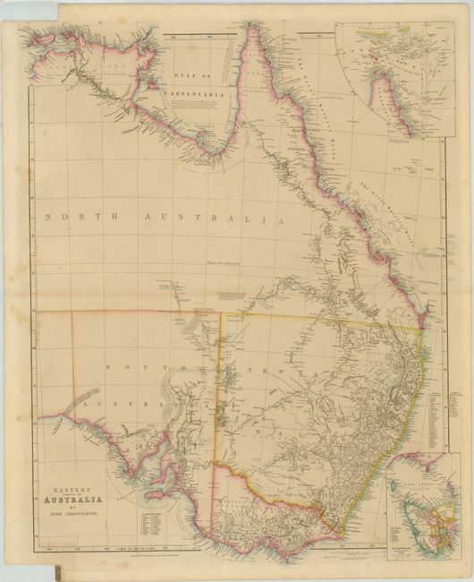
Subject: Australia

Period: 1850 (dated)

Publication: The London Atlas of Universal Geography

Color: Hand Color

Size:
19.3 x 25.3 inches
49 x 64.3 cm
Download High Resolution Image
(or just click on image to launch the Zoom viewer)

Arrowsmith’s map of Eastern Australia, published between 1838 and 1862, went through 21 states that record the exploration, settlement and development of the region. This is the 15th state, copyright dated Jan. 1, 1850. The map focuses on the southeastern region that was the area most suited to European agriculture. It is divided into three colonies: New South Wales with the separate region of Australia Felix (soon to become Victoria), South Australia, and North Australia. Forty-six counties are shown in New South Wales and 24 are listed in the Port Phillip District. Numerous spurious river systems, early settlements and important explorer’s routes are shown in the interior including Edmund Kennedy's route to Cape York from Rockingham Bay in 1847. Two insets detail the areas Cape York Peninsula with the Torres Strait and Van Diemens Land.

John Arrowsmith’s maps of the British colonies in Australia were the largest scale maps produced during the early part of the 19th century. Drawn largely from official sources and surveys, his work is of utmost importance in the cartographic history of Australia.

References: Tooley (Aust) #85; Prescott (http://www.asmp.esrc.unimelb.edu.au/).

Condition: B+

Original outline color. There are a few light spots mostly in the blank margins. Binding trim at lower left with a titled atlas tab.

Estimate: $400 - $500

Sold for: $375

Closed on 11/28/2012

Archived