Catalog Archive
Auction 142, Lot 633

"Portions of the Russian Empire in Eastern & Western Asia", Fullarton, Archibald & Co.

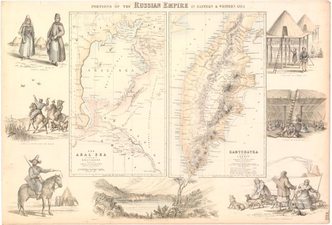
Subject: Asia - Aral Sea and the Kamchatka Peninsula

Period: 1864 (circa)

Publication: The Royal Illustrated Atlas

Color: Hand Color

Size:
18.5 x 12.5 inches
47 x 31.8 cm
Download High Resolution Image
(or just click on image to launch the Zoom viewer)

This decorative sheet includes maps of the Aral Sea and the Kamchatka peninsula. The map of the Aral Sea locates numerous place names, roads, and the routes of various military officers, including British Captain James Abbott, Russian Captain Mouravieff, and Russian Lieutenants Gladycheff and Mouravine. The map of the Kamchatka peninsula focuses on the topography of the land. Surrounding the maps are six delicately engraved vignettes depicting the different costumes, dwellings, and activities of the people from the two regions. At bottom center is a lovely view of Petropaulovski, in southeastern Kamchatka.

References:

Condition: B+

Original color with a hint of toning along sheet edges and minor foxing.

Estimate: $190 - $220

Unsold

Closed on 11/28/2012

Archived