Catalog Archive
Auction 142, Lot 487

"Hispaniae, et Portugalliae Maritimi Tractus, a S, Andero, ad Malagam", Renard/De Wit

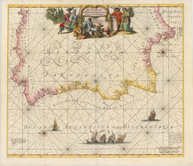
Subject: Portugal & Western Spain

Period: 1715 (circa)

Publication: Atlas de la Navigation et du Commerce...

Color: Hand Color

Size:
22.1 x 19.3 inches
56.1 x 49 cm
Download High Resolution Image
(or just click on image to launch the Zoom viewer)

This sea chart shows the western portion of the Iberian peninsula with north oriented to the left. The chart extends northeast as far as Bilbao and southeast to Malaga. The Strait of Gibraltar is labeled, and the northern tip of Morocco is also included. Names are provided for the cities, ports, capes, and islands along the coastline. A scene of a naval battle along with two ships are shown in the Atlantic Ocean, as well as two compass roses with rhumb lines. The elaborate title cartouche at the top center of the map is decorated with regional figures, illustrating contemporary dress, in addition to a decapitated figure.

References: Shirley (BL Atlases) #M.REN-1a.

Condition: B

Attractive color with a number of small worm tracks and worm holes along and near centerfold have been professionally repaired, with engraved areas replaced in facsimile.

Estimate: $550 - $650

Sold for: $300

Closed on 11/28/2012

Archived