Catalog Archive
Auction 142, Lot 392

"Mappa Aestivarum Insularum, alias Barmudas Dictarum…", Hondius, Henricus
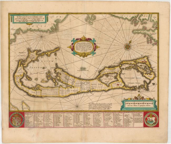
Subject: Bermuda

Period: 1633 (circa)

Publication:

Color: Hand Color

Size:
20.3 x 15.5 inches
51.6 x 39.4 cm
Download High Resolution Image
(or just click on image to launch the Zoom viewer)

A striking map based on the famous survey by Richard Norwood of the Bermuda Company, also known as the Somers Isles Company, in 1618. The map shows the division into the original Tribes, a short-lived term for the major shareholders in the company, that became administrative parishes. Also shown are the various landowners, with their names in a table below the map. There are many tiny houses shown on the map, locating settlements, as well as minute cannons marking the defensible points. The map is superimposed over a chart of the Atlantic with the coastlines of Britain, North America, and Hispaniola showing the location of Bermuda. Decorated with an exquisite strapwork cartouche, a coat of arms, a medallion and a compass rose.

References: Palmer (MCC-19) #8.

Condition: B

A nice impression with old color, light soiling, and some show-through of text on verso. There is a large chip in bottom left corner encompassing the majority of the coat of arms, just the border of the map, and a portion of the first column in the table, which has been professionally repaired with image replaced in facsimile.

Estimate: $800 - $1,000

Sold for: $600

Closed on 11/28/2012

Archived