Catalog Archive
Auction 142, Lot 34

"Orbis Terrarum Nova et Accuratissima Tabula", Aa, Pieter van der
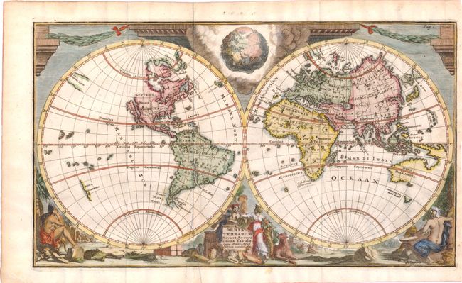
Subject: World

Period: 1729 (circa)

Publication:

Color: Hand Color

Size:
11.6 x 6.7 inches
29.5 x 17 cm
Download High Resolution Image
(or just click on image to launch the Zoom viewer)

Presented in classical format, this double-hemisphere world map depicts North America with the island of California and no Great Lakes. A partially delineated Compagnies Land fills a small part of the vast void that separates Asia from North America. Partial coastlines for Australia and New Zealand reflect the discoveries of Abel Tasman and other Dutch explorers. Allegorical female representations of the four continents fill the bottom of the decorative surround, while garland-draped columns fill the top. Tucked between the spheres in a mass of clouds is a fascinating and imaginative view of the earth bared of its waters showing the ocean floor in relief.

References:

Condition: A

Issued folding with a faint damp stain in bottom blank margin that just enters image. Trimmed close at right, but still ample room for framing.

Estimate: $650 - $800

Sold for: $450

Closed on 11/28/2012

Archived