Catalog Archive
Auction 142, Lot 302

"West Coast of North America from San Blas to San Francisco", Imray, James

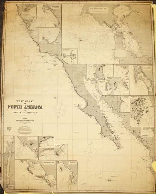
Subject: California and Baja Mexico

Period: 1868 (dated)

Publication:

Color: Black & White

Size:
40.2 x 50.5 inches
102.1 x 128.3 cm
Download High Resolution Image
(or just click on image to launch the Zoom viewer)

Striking blue-backed, working sea chart showing the coastal area from Point Delgado (Point Arena) near Mendocino down to Perula Bay at the tip of the Baja Peninsula. The map is inset with smaller charts of bays and ports along the route, including: Santa Barbara, Bodega Bay, Monterey, San Francisco Bay with South Farallon Island, Balena Bay, Mangles Road, Amortajada Bay, Pichilingue, Salinas Bay, Pulpito, San Diego Bay, Guaymas, Port San Blas, San Jose del Cabo Bay, San Lucas Bay, San Pedro, Magdalena Bay, Mazatlan, Socorro Island and Tomales Bay, an estuary near San Francisco. The map is copper engraved and has hand colored lighthouses along the coastal areas, with numerous compasses, soundings and other sailing information. Published by Imray & Son in London, with the original Imray label on verso. This firm exists today as Imray, Laurie, Norie & Wilson Ltd, still specializing in nautical charts. Printed on two sheets, joined as issued.

References:

Condition: C+

Lightly soiled with minor creases and numerous short tears in right and left blank margins just entering map border. There are several chips: in bottom left corner with loss of border, a 2 x 3" chip at right near bottom, and a couple of tiny chips in map border. Two tears that enter 2" and 4" into map at bottom have been closed on verso with archival material.

Estimate: $550 - $700

Sold for: $400

Closed on 11/28/2012

Archived