Catalog Archive
Auction 142, Lot 286

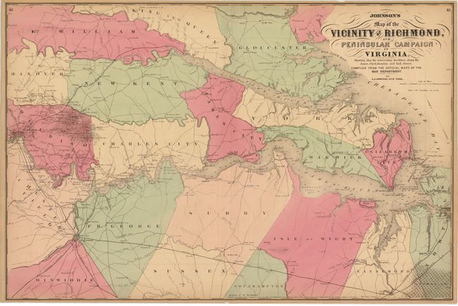
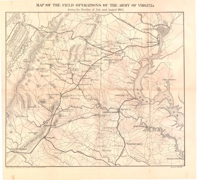
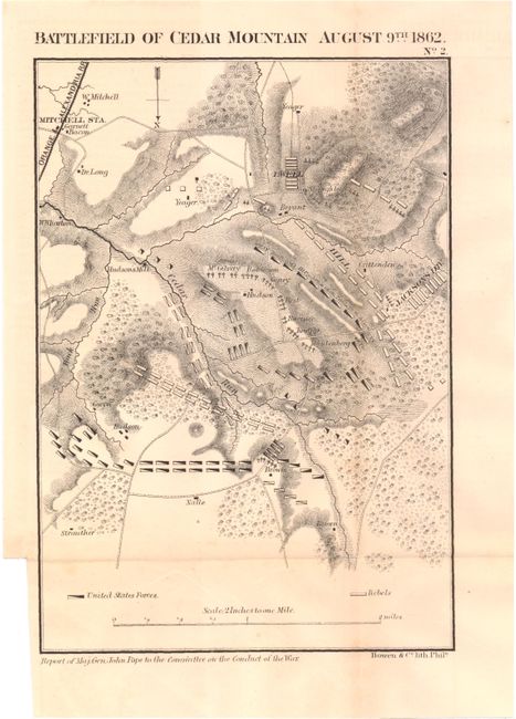
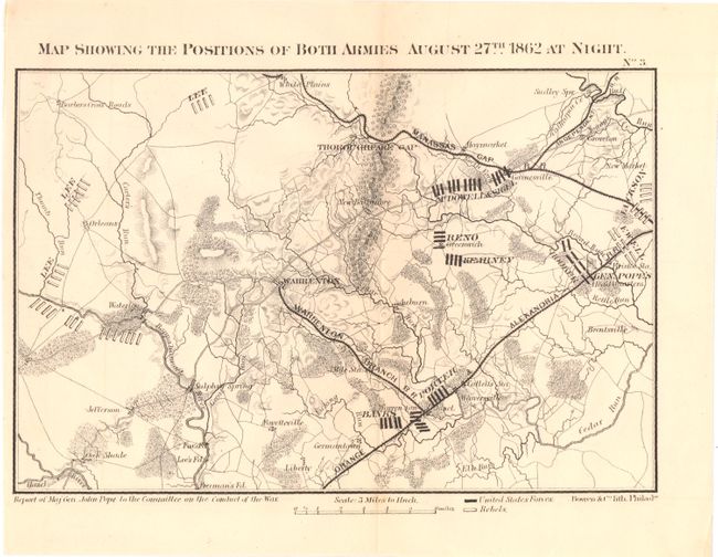
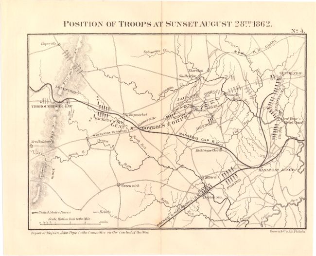
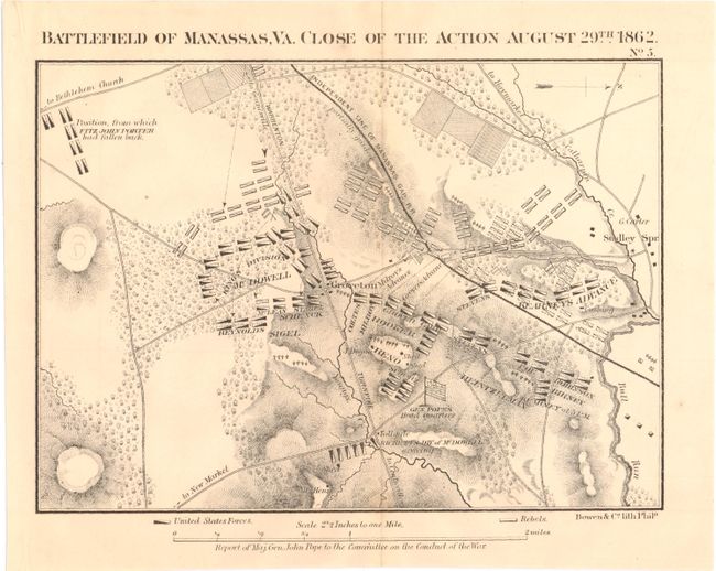
"[Lot of 6] Johnson's Map of the Vicinity of Richmond, and Peninsular Campaign in Virginia [and] [Lot of 5 - Civil War Maps of Virginia]",

Subject: Virginia, Civil War

Period: 1862 (dated)

Publication:

Color:

Size:
See Description
Download High Resolution Image
(or just click on image to launch the Zoom viewer)

A. Johnson's Map of the Vicinity of Richmond, and Peninsular Campaign in Virginia..., by A. J. Johnson, hand color (26.6 x 17.8"). A very interesting Civil War map that was compiled from the Official Maps of the War Department. This well-engraved map covers the region of the James, Chickahominy and York Rivers, and includes the cities of Norfolk, Richmond, and Petersburg. The map shows great detail of military movements, lines and fortifications. It notes the location of the "contest" between the Monitor and Merrimac on 9 March 1862, the Confederate evacuation of Yorktown, May 4 1862, the battle in the vicinity of Williamsburg, May 5 1862, the battle of Malvern Hill and several other military engagements in the vicinity of Richmond. Condition: There is a small edge tear at top that enters 0.5" into the map image. (B+)

B. [Lot of 5 - Civil War Maps of Virginia ], U.S. War Department, black & white. These maps were issued with the report of Major General John Pope to the Committee on the Conduct of the War. On the 16th of June, Pope assumed command of the Army of Virginia. His objectives were to cover Washington D. C., assure the safety of the Shenandoah Valley, and to prevent any attack from Richmond. In August the Confederate battle plan began to unfold, leading to the 2nd Battle of Manassas. These are very useful maps for understanding the military operations leading up to that battle. All issued folding, the list includes:

Map of the Field Operations of the Army of Virginia During the Months of July and August 1862, (16.6 x 15.2"). Condition: There are a couple of minor spots, a small centerfold separation at top that does not enter map image, and one small extraneous crease at top right. (B+)
Battlefield of Cedar Mountain August 9th 1862, (6.1 x 9.2"). Condition: Binding trim at lower left. (A)
Map Showing the Positions of Both Armies August 27th 1862 at Night., (9.0 x 6.3"). Condition: (A)
Position of Troops at Sunset August 28th 1862, (8.7 x 6.5"). Condition: (A)
Battlefield of Manassas, VA. Close of the Action August 29th 1862, (8.7 x 6.7"). Condition: (A)

References: Stephenson 526.5 & 573.6.

Condition:

See description above.

Estimate: $150 - $200

Sold for: $230

Closed on 11/28/2012

Archived