Catalog Archive
Auction 142, Lot 210
"Map Showing Indian Reservations in the United States West of the 84th Meridian and Number of Indians Belonging Thereto", U.S. Government
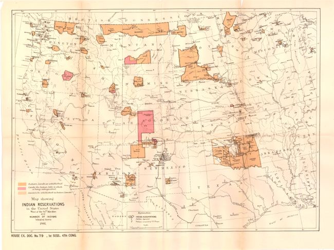
Subject: Southwestern United States
Period: 1881 (dated)
Publication: HR Ex Doc. 79, 47th Cong, 1st. Sess.
Color: Printed Color
Size:
18.1 x 13.1 inches
46 x 33.3 cm
Download High Resolution Image
(or just click on image to launch the Zoom viewer)
(or just click on image to launch the Zoom viewer)