Catalog Archive
Auction 142, Lot 200

"Stati e Territorii Occidentali della Unione Americana", Marmocchi, Francesco

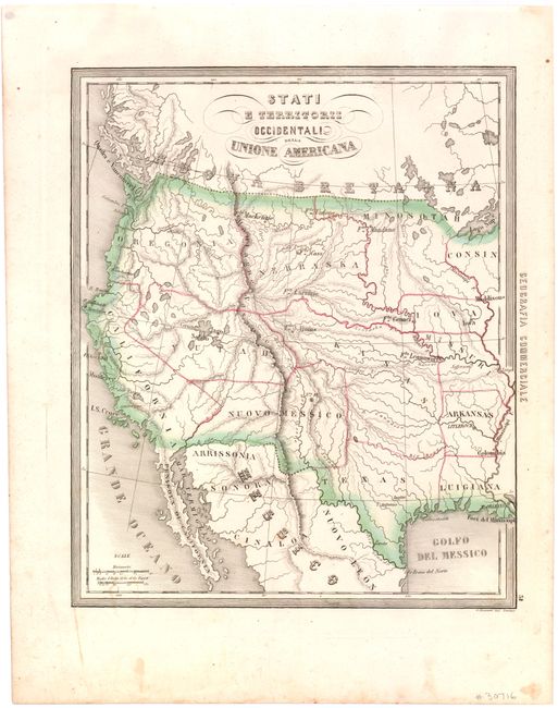
Subject: Western United States

Period: 1850 (circa)

Publication: Corso di Geografia Commerciale

Color: Hand Color

Size:
10.8 x 13.2 inches
27.4 x 33.5 cm
Download High Resolution Image
(or just click on image to launch the Zoom viewer)

This is a very scarce Italian map illustrating the western part of the United States. The map shows the region with a pre-Gadsden Purchase border with Mexico. It covers the area from the Mississippi River to the west coast. All the states and territories are misshapen. A large Kasas territory covers present-day Oklahoma, Kansas and Nebraska. In the Pacific Northwest, there is a large Oregonia territory that covers Washington, Oregon and Idaho. < I>Yutah envelopes the Gran Iago Salato (Great Salt Lake) and the headwaters of several spurious rivers that flow through the Great Basin to the Pacific. One of the most interesting features of the map is the region labeled Arrissonia below the Gila River. This is one of the earliest notations regarding Arizona. There are a number of important forts noted.

References:

Condition: B+

A few tiny stains, including one damp stain in bottom margin, just entering image.

Estimate: $275 - $350

Sold for: $220

Closed on 11/28/2012

Archived