Catalog Archive
Auction 142, Lot 187

"Map of the Southern States of North America with the Forts, Harbours & Military Positions", Wyld, James

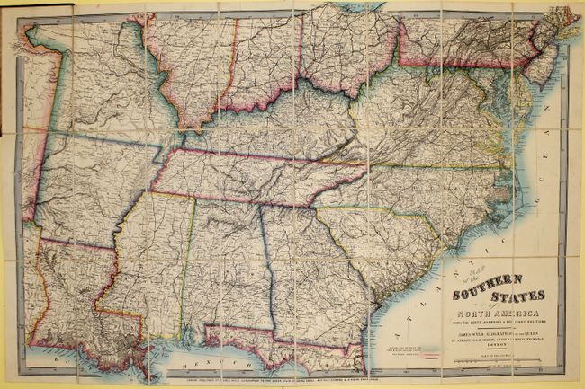
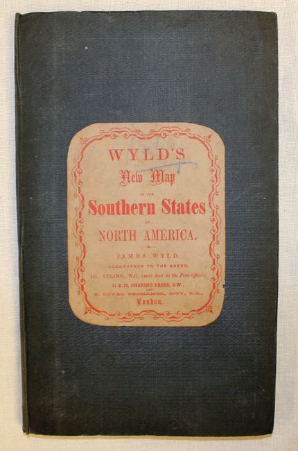
Subject: Southern United States

Period: 1861 (circa)

Publication:

Color: Hand Color

Size:
39 x 26.5 inches
99.1 x 67.3 cm
Download High Resolution Image
(or just click on image to launch the Zoom viewer)

This important map indicates the dividing line between the Union and Confederate states. The map covers the area from Long Island in the northeast to eastern Texas and Indian Territory in the southwest. KanzasTerritory is shown in the northwest, despite Kansas achieving statehood in January of 1861. Military bounty lands are noted in Missouri. There is good detail of completed railroads and canals, and the map locates numerous towns and forts including Fort Gibson, Scott and Towsen. Wyld's map was widely used in Britain to demonstrate the conflict in America. The map is dissected into 24 sections and backed with linen. Folds into green cloth covered boards with a pastedown title.

References:

Condition: A

Very bright and colorful with only a few small spots in the image and a closed edge tear at top. Covers are worn with ink markings on pastedown.

Estimate: $1,600 - $1,900

Sold for: $1,200

Closed on 11/28/2012

Archived