Catalog Archive
Auction 142, Lot 180

"Kaart van het Zuidelyk Gedeelte der Vereenigde Staaten van Noord Amerika Carte de la Partie Sud des Etats Unis", Bachiene, Willem Albert

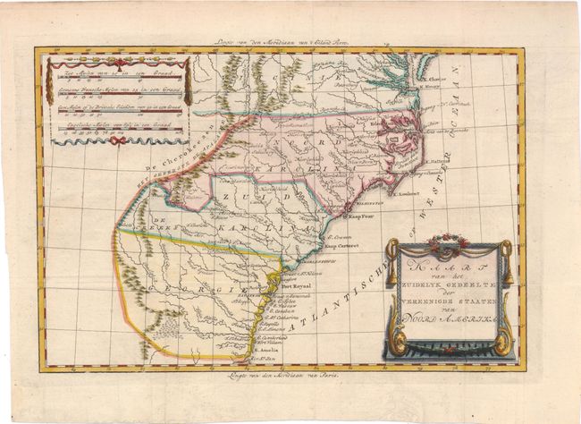
Subject: Southeast United States

Period: 1785 (published)

Publication: Atlas tot Opheldering der Hedendaagsche Historie

Color: Hand Color

Size:
12.5 x 8.3 inches
31.8 x 21.1 cm
Download High Resolution Image
(or just click on image to launch the Zoom viewer)

This uncommon map covers the southeast portion of the infant United States. All settlement is confined east of the Appalachians with De Cherokeezen the only note in the otherwise blank region west of the mountains. The map is based on the cartography of Bonne, with the addition of decorative details on both the scale and title cartouches.

References: cf Sellers & Van Ee #1406.

Condition: A

Issued folding, now pressed, on watermarked paper with minor offsetting.

Estimate: $275 - $350

Sold for: $200

Closed on 11/28/2012

Archived